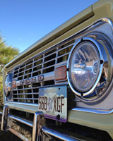
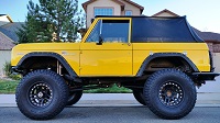
I plan on pre-running a 335 mile GPS track I built to test the Baja Racer later in the early Fall on June 29 and 30. The GPS track starts near the airport in Grand Junction, follows various graded roads and marked trails through areas north and west of Grand Junction, across the Utah border and then into the northern Moab area to the Green River, loops around across the main road to Moab and then utilizes a portion of the kokopelli trail ending near Fruita Colorado.
I will be recording the actual track via LeadNav to make sure the route is run-able in September in the Racer. Just throwing this out there as it would be nice to have one or two others along just in case. Not much if any rock crawling, expect lots of sand in the Northern Moab area, graded roads for the majority of it, some rough sections on the kokopelli trail, it will be pretty warm.
I plan to leave Denver Friday June 28 in the late afternoon, spend the night in Grand Junction, be on the trail before sunrise and run as much as I can Saturday before it gets too blazing hot. Camp Saturday or stay the night in Moab, get up before sunrise on Sunday and run the remaining trail.
Anyway, this is very informal, I will NOT be running this at race speed now or when I run it in September as we are using it as an opportunity for seat time, testing comms and other stuff.
I will be taking 5 gallons of water and I might take extra fuel however there are plenty of opportunities for fuel stops along the way if need be.
If you want to tag along let me know.
I have a link to the KML and GPX file. The KML you can open in Google Earth Pro, the GPX can be opened in various other programs GPS units.
Google Map link:
https://www.google.com/maps/d/viewer?mid=13aS_SzjbDyfkKRxFEavrvzLsriihC8q3&hl=en&usp=sharing
Zip with the GPS files.
https://drive.google.com/file/d/1jqwi_cS5BeNlpgatMS3EbCNdOW4wKGOo/view?usp=sharing
Grand Junction - Moab - Grand Junction PreRun June 29 and 30
2 posts
• Page 1 of 1
Grand Junction - Moab - Grand Junction PreRun June 29 and 30
You do not have the required permissions to view the files attached to this post.
1976 Bronco "Green, Yellow, whatever", 1969 Bronco "Red", 1972 Bronco Stocker "Kind of Blue/Grayish"
-

landshark - Official CCB Member

- Posts: 3942
- Joined: Thu Oct 13, 2011 11:16 pm
- Location: Denver, Wash Park Area
Re: Grand Junction - Moab - Grand Junction PreRun June 29 an
That's looks like a lot of fun!
I wish I would have my rig back together by then. It would have been a good chance to test the driving range on the diesel.
I wish I would have my rig back together by then. It would have been a good chance to test the driving range on the diesel.
Cummins R2.8 diesel, ZF5, AtlasII, HP44/BB9, ARBs, coiled / linked suspension, 37" KO2s, full cage, bumpers, etc.
Build Thread: http://www.coloradoclassicbroncos.com/viewtopic.php?f=3&t=5420
Average 23.5 mpg, Best tank: 25.1 mpg
Build Thread: http://www.coloradoclassicbroncos.com/viewtopic.php?f=3&t=5420
Average 23.5 mpg, Best tank: 25.1 mpg
-

Digger - Official CCB Member

- Posts: 1276
- Joined: Fri Jun 21, 2013 7:53 pm
2 posts
• Page 1 of 1
Who is online
Users browsing this forum: No registered users and 4 guests
